 Main Menu


 New Posts
 New Replies

 Personal Menu


 Users online
 Stats
Stats
 Total Members: 621
 Total Posts: 62693
 Total Topics: 2611
 Total Categories: 9
 Total Boards: 59
 Calendar


 Forum News
Welcome To The Irish Weather Network!
 Forecasts
[%
Cool Weekend - wet Sunday evening...

SATURDAY: After an overcast start with local showers, sunny spells will develop. Feeling cool though in a fresh NE wind. Highest temperatures will reach 9c to 12c. OVERNIGHT: Feeling very cold as temperatures drop to between 0c and 3c under clear skies in a fresh and gusty NE wind. Some grass frost is likely.
SUNDAY: A fine cold crisp start to the day in a fresh and gusty E to NE wind, however cloud will increase from the SE in the early afternoon with rain developing mid-afternoon. Highest temperatures will range from 8c to 11c. The rain will become heavy for a time in the evening, but OVERNIGHT the rain will become lighter and more patchy as it clears northwestwards. The wind will also moderate, backing SE for a time before settling into a NE direction once more. Lows will range from 3c to 6c.
MONDAY: Any early morning rain will clear to mostly dry conditions for the afternoon, perhaps a few showers in the east. Highs will range from 11c to 14c in moderate NE winds. Into the evening and OVERNIGHT, cloud will build over the south and southeast bringing scattered outbreaks of light rain or drizzle. Lows will range from 3c to 8c in light to moderate E to SE winds. Coolest in the west and north under mostly clear skies.
TUESDAY: Showers of light rain and drizzle in the morning over south eastern regions, but the other areas will remain mostly dry with some bright or sunny spells. Fresh easterly winds will become moderate during the day. Highs of 10c in the cloudier east to 14c or 15c in the west.
OUTLOOK: Apart from some showers in the east, it looks like remaining mostly dry throughout the week in rather cool E to NE winds. Temperatures will range from 10c to 15c each day, mildest in the west. The nights will be cool with lows between 2c and 5c generally, but the nights will become colder towards the end of the week, dropping below 0c at night – so frosts will become an issue once more.
BANK HOLIDAY WEEKEND THOUGHTS: Present thoughts suggest a cool weekend, especially in the east where showers will become widespread. Further west and into the SW it may remain dry and slightly milder. The nights will be cold and frosty.
FOR UPDATES: You can keep up to date right here on our forum or by following us on Twitter @Irelandsweather
We also would like to get any Spring like photos submitted to for our Facebook Spring album
Forecast issued April 28th at 1600
%]
Subscribe to the forecasts by email
Archived Forecasts found here
Cool Weekend - wet Sunday evening...
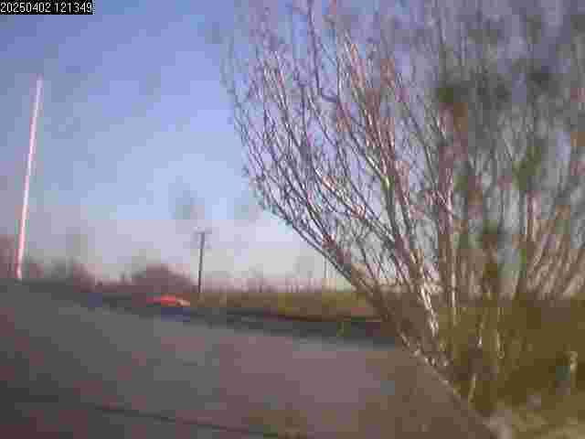
Picture by LaoisWeather
SATURDAY: After an overcast start with local showers, sunny spells will develop. Feeling cool though in a fresh NE wind. Highest temperatures will reach 9c to 12c. OVERNIGHT: Feeling very cold as temperatures drop to between 0c and 3c under clear skies in a fresh and gusty NE wind. Some grass frost is likely.
SUNDAY: A fine cold crisp start to the day in a fresh and gusty E to NE wind, however cloud will increase from the SE in the early afternoon with rain developing mid-afternoon. Highest temperatures will range from 8c to 11c. The rain will become heavy for a time in the evening, but OVERNIGHT the rain will become lighter and more patchy as it clears northwestwards. The wind will also moderate, backing SE for a time before settling into a NE direction once more. Lows will range from 3c to 6c.
MONDAY: Any early morning rain will clear to mostly dry conditions for the afternoon, perhaps a few showers in the east. Highs will range from 11c to 14c in moderate NE winds. Into the evening and OVERNIGHT, cloud will build over the south and southeast bringing scattered outbreaks of light rain or drizzle. Lows will range from 3c to 8c in light to moderate E to SE winds. Coolest in the west and north under mostly clear skies.
TUESDAY: Showers of light rain and drizzle in the morning over south eastern regions, but the other areas will remain mostly dry with some bright or sunny spells. Fresh easterly winds will become moderate during the day. Highs of 10c in the cloudier east to 14c or 15c in the west.
OUTLOOK: Apart from some showers in the east, it looks like remaining mostly dry throughout the week in rather cool E to NE winds. Temperatures will range from 10c to 15c each day, mildest in the west. The nights will be cool with lows between 2c and 5c generally, but the nights will become colder towards the end of the week, dropping below 0c at night – so frosts will become an issue once more.
BANK HOLIDAY WEEKEND THOUGHTS: Present thoughts suggest a cool weekend, especially in the east where showers will become widespread. Further west and into the SW it may remain dry and slightly milder. The nights will be cold and frosty.
FOR UPDATES: You can keep up to date right here on our forum or by following us on Twitter @Irelandsweather
We also would like to get any Spring like photos submitted to for our Facebook Spring album
Forecast issued April 28th at 1600
%]
Subscribe to the forecasts by email
Archived Forecasts found here
Added to portal by LaoisWeather - April 28, 2012, 15:50:41
Pages: 1 2 3 4 5 6 7 8 9 10 11 12 13 14 15 16 17 18 19 20 21 22 23 24 25 26 27 28 29 30 31 32 33
IWN Weather Table
Monthly Weather Table for the Month of March 2012
Summary:
*Another very mild month (mildest since 1957, at most long term sites).
*Rainfall was below normal everywhere.
*Sunshine was above normal
Notes:
*All stations above use standard Met Eireann approved equipment.
*Mean temperatures are calculated based on max/min over day period from 9 UTC to 9 UTC next day.
*Ireland Average is based on 3 stations : Armagh, Dublin and Valentia.The data shown for these stations is provisional.
*Anomalies are based on the 1961-1990 data series.
Summary:
*Another very mild month (mildest since 1957, at most long term sites).
*Rainfall was below normal everywhere.
*Sunshine was above normal
| Station | Mean Max | Mean Min | Mean | Mean Anom. | Month Max | Month Min | Air Frosts | Rainfall(mm) | Rainfall % | Total Sun (hrs) | Sun % |
| Armagh |
12.6
|
4.7
|
8.7
|
+2.8
|
21.0
|
-0.8
|
1
|
15
|
23
|
134
|
140
|
| Ashford |
13.2
|
4.7
|
9.0
|
+2.5
|
19.4
|
-1.4
|
2
|
28
|
39
|
154
|
|
| Casement |
12.6
|
5.1
|
8.9
|
+2.8
|
19.8
|
0.1
|
0
|
26
|
55
|
131
|
131
|
| Durrow |
12.8
|
4.3
|
8.5
|
+2.4
|
19.8
|
-1.2
|
4
|
17
|
25
|
n/a
|
n/a
|
| Killucan |
12.5
|
3.9
|
8.2
|
+2.5
|
19.3
|
-1.9
|
6
|
13
|
|
n/a
|
n/a
|
| Kilkenny |
13.4
|
4.5
|
8.9
|
+2.7
|
20.4
|
-1.5
|
4
|
26
|
41
|
n/a
|
n/a
|
| Valentia |
13.2
|
7.5
|
10.3
|
+2.7
|
20.2
|
2.4
|
0
|
42
|
35
|
134
|
142
|
| Ireland Average : | Temp | (Anom.) | Rainfall | (% Anom.) | Sunshine | (% Anom.) |
| 9.3 | (+2.8 ) | 28 | (35) | 133 | (136) |
Notes:
*All stations above use standard Met Eireann approved equipment.
*Mean temperatures are calculated based on max/min over day period from 9 UTC to 9 UTC next day.
*Ireland Average is based on 3 stations : Armagh, Dublin and Valentia.The data shown for these stations is provisional.
*Anomalies are based on the 1961-1990 data series.
 Latest Updates
|
May 2012 - Current Conditions (Spring)
Last update: DOC - Today at 08:05:39 |
 |
Carne Beach Wexford 29-04-12
Last update: StratoQ - Today at 01:05:28 |
|
Top 5 Highest Air Temperatures by month and year of 2012
Last update: StratoQ - Today at 00:59:39 |
|
Record breaking heat for April - Central and Eastern Europe
Last update: StratoQ - Today at 00:53:22 |
|
Large Wind Farms Increase Temperatures Near Ground
Last update: StratoQ - Yesterday at 23:39:28 |
|
April 2012 - Current Conditions (Spring)
Last update: Pad - Yesterday at 22:14:20 |
Twitter #iwn
IWN Facebook
Support
Please help support this site
Thanks.
Thanks.
 HighTemps of 2012
Highest of year to date:
Highest Temperatures for 2012
Highest Temperatures for 2012
| Temp. | Station | Date |
| 22.2 | Belmullet, Co Mayo | Mar 27th |
| 21.4 | Giants Causeway, Co Antrim | Mar 27th |
| 21.0 | Castlederg, Co Tyrone | Mar 27th |
| 20.9 | Ballykelly, Co Derry | Mar 25th |
| 20.7 | Phoenix Park, Dublin | Mar 25th |
| 20.3 | Mount Dillon, Co Roscommon | Mar 25th |
| 20.3 | Magilligan, Co Derry | Mar 25th |
 Top Posters
|
Snowbie Messages: 8480 |
|
|
Damo Messages: 6371 |
|
 |
LaoisWeather Messages: 5702 |
|
Pad Messages: 5617 |
|
|
DOC Messages: 5219 |
|
|
Mothman Messages: 3197 |